The implementation of the dialogue space is based on a participatory approach. It seeks to identify the challenges, risks, opportunities, and strengths from the point of view of the men and women of the local communities of the CARIFORUM countries through two complementary techniques: social mapping and photographic recording.
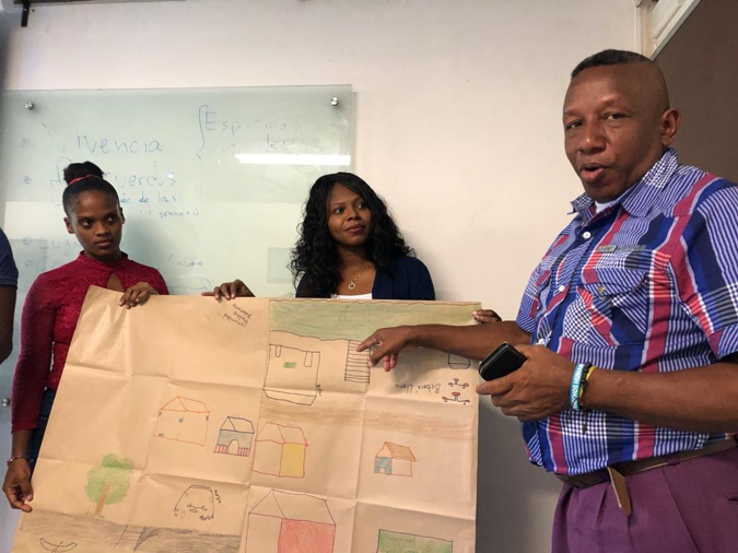
On the one hand, mapping aims to identify and map social spaces (places such as wells, pipelines, tanks, sanitation systems, collection and storage systems, ecosystems, etc.), where men and women experience challenges and risks, while at the same time identifying opportunities and strengths for building their development.
On the other hand, the photographic register is proposed as a working instrument to illustrate the spaces identified in the cartography, in order to reconstruct the histories and meanings that these spaces have for men and women.
The use of photographic records or photovoice along with community knowledge and evidence of best practice can lead to the development of effective and inclusive strategies to address complex environmental and social issues in a way that is also relevant to the community involved.
Proposal of thematic contents for the dialogue of knowledge
The topics to be addressed during the dialogue of knowledge are defined according to the themes of the modules of the training programme.
The documents to be used by the water entities/trainers are short documents available on this website and adapted to the audience of the local communities.
Note: The dialogue of knowledge presented in this occasion is intended to be carried out in a short period of time. However, it should be noted that it is recommended that the dialogue takes place over at least two days. The first day is devoted to drawing up the map and asking for photographs to be taken. The second day – preferably 5 to 7 days later – is spent working on the photographs.